June 29, 2015, The YUKON-North West Territories
The morning started with coffee with my new friends from the Upper Peninsula of Wisconsin. They’re traveling north as well and we shared a dinner table last night at the Toad River Lodge. Mike and Rita are from the UP (Wisconsin’s Upper Peninsula) near Lake Superior and the Minnesota / Wisconsin border. They are on a two month jaunt around the Yukon and Alaska and we shared some northbound Alaska Highway stories from the past few days that ranged from bicyclists to truckers and finally to the old people towing trailers … man that last one is a scary thing. We’ve seen some crashes and people just don’t get that when you crash out here you are on your own for a very long time. It’s a 24-hour deal being involved in a wreck out here. Our consensus was you just can’ t fix stupid. Hahaha, we’ve heard that before!
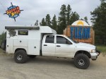
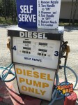
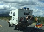
CASPER the Dodge RAM 4WD Diesel truck is equipped with a 72-gallon diesel tank that sits in the position of the original tank. Averaging roughly 15 miles a gallon in the burly beast gives us a range of around 1000-miles and while we don’t push the limits with that we have plenty of diesel to go exploring some of the backcountry dirt roads that lead of this Alaska Highway.
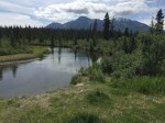
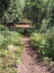
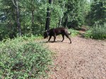
Sometimes we venture off 10 miles and other times we’ll follow the 2-track dirt road for 50 miles seeing what we can find and you just never know when there is another swimming hole for Diezel the dog.
We are using Lowrance GPS system backed up with a Garmin Montana 650 and have some very detailed background maps loaded to the units. So far all the roads and trails have been spot on.
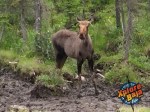
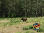
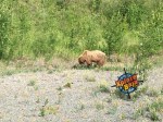
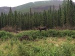
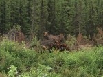
We kicked out of Toad River today after coffee and a hot shower and only 10 miles north we came across a herd of Caribou meandering along the roadside shoulder. A few other travelers were stopped blocking traffic so they could get closer but the Caribou were not having any part of it. 25 miles further a moose drank from the muddy waters next to the highway.
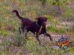
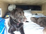
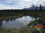
After another 25 miles down the road we stopped to let Diezel swim in the river. The ongoing game of how many times can I fetch the stick was won by none other than the dog. He continually wears me out each and every time. He does not care how cold the water is or how many times he has to run up the steep river bank he just swims and thinks he’s a shark.
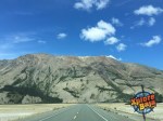
Onward and 5 minutes into our travels we encountered gnarly heavy smoke that slowed us down even though we saw no other north bound traffic. I figured it would clear up in 5-10 miles but it continued and at times it became thicker and thicker. We approached Coal River, Yukon and it was the heaviest, but we continued onward. After 150 miles of heavy smoke it all cleared up in less than ½ mile. The sky and each and every mountain valley and canyon was filled with the heavy smoke.
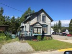
50 miles later in Watson Lake we stopped for some lunch at a renown café, Kathy’s and I scored an awesome fried chicken that was out of this world.
Watson Lake is one of the main intersections in the entire Yukon. This is where you decide to take the East Route or West Route to and from Alaska. Another highway heads to towns named Ross and Faro, which are deep into Yukon gold mining country. In fact, daily we have seen gold miners loaded with gold mining gear all headed north in search of their dreams. They are at each fuel stop and their trucks and flatbed trailers are overloaded with hoses, pumps and mining gear and they have the look on their face of desperate hope.
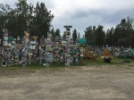
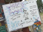
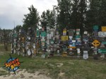
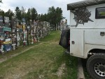
It wasn’t hard to find the Sign Forest that our friend North Pole Nancy told me about. The Sign Forest was started in 1943 by an American G.I. who hung 5 signs of his buddies hometowns here in Watson Lake while he was stationed here building the Alaskan Highway. Nowadays they claim there are 50,000 signs from around the world hanging in the Sign Forest. Travelers bring their own city signs, personal signs etc. and hang them in the Sign Forest to share with the world. It’s quite a spectacle to see in person.
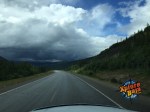
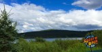
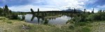
We headed north and within 15 minutes the rain was pounding and didn’t stop for the next 4 hours. I am talking torrential sideways heavy rain! Finally, after 250 miles it broke and the clouds scattered a bit, but the road remained slippery and we were shot. We started searching for a camp and found a quiet place along the shores of Teslin Lake. The breeze is strong along the lakefront making it chilly tonight. Temperatures today hovered right in the low 60’s and during the rainstorm it dropped to the mid-50’s. It’s perfect sleeping weather.